The Bay Area is located on the Pacific Coast midway between San Francisco, California and Seattle, Washington. The communities of Coos Bay, North Bend, and Charleston are approximately 115 miles from Eugene, Oregon’s second largest city. The county was formed from the western parts of Umpqua and Jackson Counties. The seat of the county is Coquille.
With a county population of approximately 64,487, Coos County offers a rural setting with numerous outdoor activities including hunting, fishing, camping, hiking, beach combing and golfing; all in a mild climate. The size of Coos County also means the people can become actively involved with their schools, neighbors, and community service groups.
Surrounded by the Pacific shoreline with its beautiful dunes and lovely beaches, Oregon’s Adventure Coast is located between the Oregon Dunes National Recreation Area on the North and Shore Acres State Park, an impressive botanical garden on a cliff overlooking the Pacific Ocean, on the South. The area features a variety of outdoor activities including fishing, clamming, wildlife, bird watching, sea lion and whale watching, tours, cycling, and 4-wheel rides in the dunes. The Port of Coos Bay is an active commercial area.
The Coos Bay area also offers a wide range of shopping, entertainment and dining facilities such as Pony Village Shopping Mall, renovated downtown Coos Bay, antique, myrtlewood and gift shops, theatres, and an art museum and gallery.
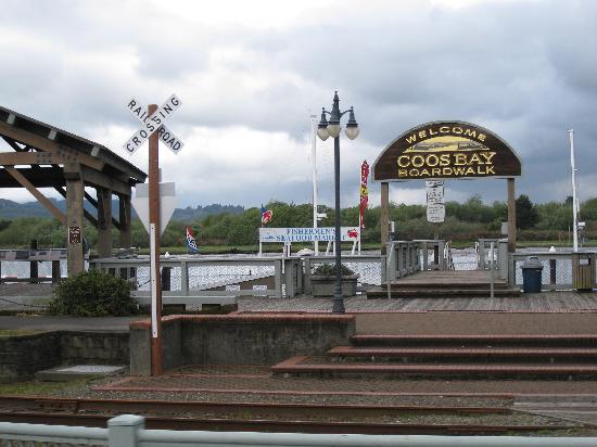
Coos Bay is the largest community on the Oregon Coast. It has been the commercial center of Oregon’s southern coast since its earliest days.
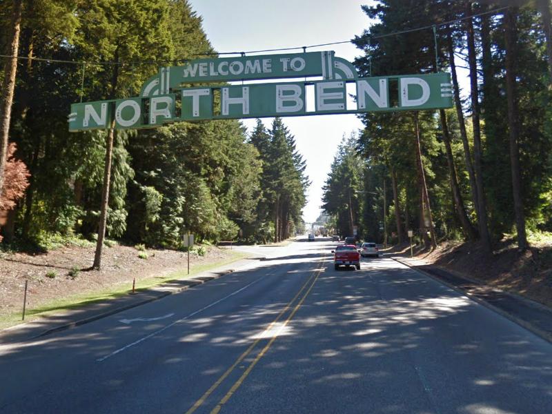
North Bend, with its magnificent McCullough Bridge, is the northern gateway to the Bay Area. It boasts a history of great innovators and business people. Asa M. Simpson and his son Louis were prime movers in the town’s development. North Bend was the hub of their northwestern timber holdings.
Pony Village Mall, the largest indoor shopping center on the coast and The Mill Casino – Hotel are located in North Bend.
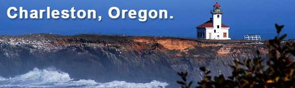
Charleston is a quaint fishing village just eight miles from Coos Bay and North Bend and is located just inside the entrance to the bay. Charleston is home to some of the finest recreation and most beautiful scenery in the Northwest.
The harbor is the heart of this community and serves as a home port to a large commercial fishing fleet. You’ll find a bustling marina serving charter boat operators, sports fishermen, crabbers and recreational boaters. The harbor area includes restaurants, tackle, seafood, and specialty gift shops. Unique seafood restaurants will appease any palette. You can choose from the Portside which sends its own boats out to catch the fresh fish of the day, the Oyster Cove which was featured on Rachel Ray, and the High Tide Café serving arguably the best fish and chips around. If you’d like a more authentic experience, stop by our fish markets. Go to Fisherman’s wharf on the D Docks to pick out your crab to be cooked and cleaned for you to take home or eat right there on the docks or stop by Chuck’s seafood for fresh oysters and clams.
Charleston is Oregon’s Adventure Coast’s gateway to outstanding ocean beaches, state parks, and stunning untouched scenery. Follow Cape Arago Highway and you’ll hit a trifecta of beauty in Sunset Bay State Park, Bastendorff Beach and the renowned Shore Acres State Park. You’ll find world class surfing, kayaking and scuba diving opportunities along with hiking and biking trails suited to all levels.
Directions from North I-5
I-5 South to exit 162. Merge onto Hwy 38/Hwy 99 toward Drain/Elkton. Take Hwy 38 to Hwy 101 in Reedsport. Turn south on Hwy 101 and go approximately 26 miles.
Directions from South 1-5
I-5 North. Take exit 119 toward Hwy 99S/Winston/Hwy 42W/Coos Bay. Merge onto Coos Bay-Roseburg Hwy. Take a slight left at Maryland Ave then continue on 8th St/Coos Bay-Roseburg Hwy/ Hwy 42.
Flying Here (Airport Code OTH)
Your gateway to Adventure begins at the newly built Southwest Oregon Regional Airport. We boast the only commercial airport on the Oregon Coast with daily, non-stop flights to and from Portland and San Francisco! Serviced by United Express and Seaport Airlines, for ticket information, please visit www.united.com or www.SeaportAirlines.com.
RULES OF THE ROAD
There’s a few things you need to know about driving in Oregon:
Hands free – That means only hands free mobile devices are allowed to be in use while driving.
Gas stations – in Oregon we pump your gas! So please sit back and relax and let one of our gas station attendants take care of you. Don’t be shy about asking for your windshield cleaned, we’re happy to serve you. Tipping is not required as this service is part of Oregon Law.
Speed limits – Along most of the coastal portions of the Oregon coast, the speed limit ranges from 50 – 55 mph. Please be sure to follow the posted signs and give yourself a little extra time, we’d hate for a speeding ticket to taint your road trip. When approaching windy areas or towns along highway 101, be prepared to reduce your speed. The coastal route is so beautiful you won’t mind slowing down.
SAFETY
We want to make sure that you’re safe and sound while visiting, so here’s a few tips to remember:
- While our oceans are beautiful and there for your enjoyment, please remember to respect the power of the ocean.
- Be careful of sneaker waves, they carry a dangerous undertow and as the name reflects, can sneak up on you.
- There are no lifeguards on our beaches.
- Never turn your back on the ocean.
- Be wary, especially in winter months and utilize our storm watching sites during inclement weather.
- The safest areas to view winter storms are at the storm watching hut at Shore Acres State Park, the bluff overlooking Bastendorff Beach, and Sunset Bay State Park.
Tsunami’s- Safe Zone Map
While traveling on the coast, you’ll notice signs pointing to Tsunami safe zones. Tsunami’s are rare, but it’s still important to be up-to-speed on safety information and know what to do. Click here for a list of tips and safe zones. Our area is equipped with a tsunami warning system so you’ll hear a series of loud warning sirens letting you know when it’s time to get to higher ground.